 One Click...
to all things local!
Old Richmond Historic District
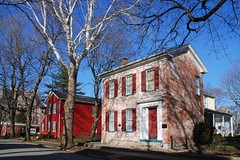
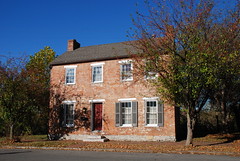
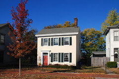
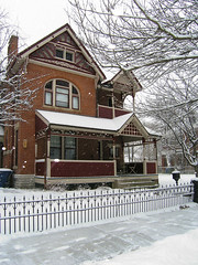
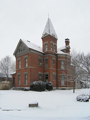
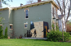
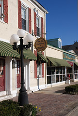
With more than 213 structures of historic importance, this neighborhood was first settled by members of the Society of Friends, later by free blacks and German immigrants. Enrolled on the National Register of Historic Places, several significant structures were catalogued by the Historic American Buildings Survey. Today, quaint shops and restaurants are nestled in and among the fine residential structures.
Click to see our Old Richmond photo set on Flickr.
 |
 |
 |
 |
 |
 |
 |
 |
 |
 |
 |
 |
Old Richmond Historic District (added 1974 - - #74000025)
Roughly bounded by C & O Railroad, S. 11th, South A, and alley South of South E St. , Richmond
Historic Significance: Person, Event, Architecture/Engineering
Architect, builder, or engineer: Multiple
Architectural Style: Mixed (More Than 2 Styles From Different Periods)
Historic Person: et al., Quinn,William Paul
Significant Year: 1840, 1818
Area of Significance: Politics/Government, Black, Education, Architecture, Commerce, Transportation, Social History, Religion
Period of Significance: 1850-1874, 1825-1849, 1800-1824
Owner: Local , Private
Historic Function: Commerce/Trade, Domestic, Religion
Historic Sub-function: Business, Religious Structure, Single Dwelling
Current Function: Commerce/Trade, Domestic, Religion
Current Sub-function: Business, Religious Structure, Single Dwelling
Old Richmond Historic District (Boundary Increase and Decrease) (added 2003 - - #03001319)
Also known as 177-536-42000Roughly bounded by South A, 11th and E Sts., and the C & O Railroad tracks to the west, Richmond
Historic Significance: Event, Architecture/Engineering
Architect, builder, or engineer: Hasecoster, John a., Trowbridge & Ackerman
Architectural Style: Greek Revival, Federal
Area of Significance: Exploration/Settlement, Social History, Black, Architecture, European, Transportation
Period of Significance: 1925-1949, 1900-1924, 1875-1899, 1850-1874, 1825-1849, 1800-1824
Owner: Local , Private
Historic Function: Commerce/Trade, Domestic, Government, Landscape, Religion
Historic Sub-function: Correctional Facility, Multiple Dwelling, Park, Religious Structure, Single Dwelling, Specialty Store
Current Function: Commerce/Trade, Domestic, Landscape, Religion
Current Sub-function: Multiple Dwelling, Park, Religious Structure, Restaurant, Single Dwelling, Specialty Store
![]()
![]()
![]()
![]()
Location
Roughly bounded by South A, 11th and E Streets, and the C & O Railroad tracks
Richmond, Indiana
Admission
Public Access - Free
Tours
Walking Tour Information Guide Available from the Tourism Bureau
765.935.8687 or 800.828.8414
|
This jQuery slider was created with the free EasyRotator software from DWUser.com.
Need a powerful Flash slideshow creator with built-in iPhone/iPad/Android support? EasyRotator is supported by the XML Flash Slideshow v4 Software. OK |
This jQuery slider was created with the free EasyRotator software from DWUser.com.
Need a powerful Flash slideshow creator with built-in iPhone/iPad/Android support? EasyRotator is supported by the XML Flash Slideshow v4 Software. OK |
|
This jQuery slider was created with the free EasyRotator software from DWUser.com.
Use WordPress? The free EasyRotator for WordPress plugin lets you create beautiful WordPress sliders in seconds. OK |
This jQuery slider was created with the free EasyRotator software from DWUser.com.
Use WordPress? The free EasyRotator for WordPress plugin lets you create beautiful WordPress sliders in seconds. OK |
Featured Member
Did You Know?
Wayne County Fast Facts
| Location: | East Central Indiana, USA |
| Founded: | 1810 |
| Population: | 66,456 |
| Elevation: | 1,257 feet Highest Point in Indiana |
| County Seat: | Richmond |
| Local Time: | |
| Date: | |
| About Indiana: | IN.gov |
| Current Weather: |
Follow Us
Contact Us
| Email: | info@waynet.org |
| Phone: | 765.939.0857 |
| Mail: | 50 North 5th St. Richmond, IN 47374 |
| Director: | Board of Directors |
Stay in Touch
Sign up for WayNet News
- our e-newsletter.
Translate This Page
Join WayNet
About WayNet
Waynet, Inc. is a non-profit, 501(c)4 corporation that is fully-funded through memberships. Please support our members and let them know you located them via WayNet.org.
Top 25: popular pages & circulation information.
Our Recent Tweets
Copyright © Waynet, Inc. 2022, All Rights Reserved.| Policies
Directory | News | Discover | Find It Fast | Knowledge | To Do | Members


